
Features RandoCartes (hiking maps)
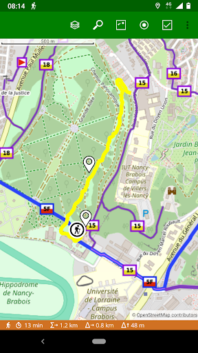
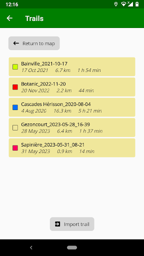
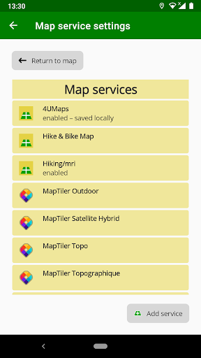
This application allows you to display maps from the following services:- 4UMaps (World)- Hiking/mri (Europe)- MapTiler (World) — needs a free subscription- OpenStreetMap (World)- OpenTopoMap (World)- ÖPNVKarte (World)- Thunderforest (World) — needs a free subscription- WanderReitKarte (Europe)You can also add other WMTS map services.You can save maps locally on your device so that they are available when you have no connection.You can display trails imported from GPX files and also record your own walks in this format.
Social Features
Connect and share with friends and the community.
Gaming Features
Enjoy immersive gaming experience with various game modes.
News & Updates
Stay informed with the latest news and updates.
See the RandoCartes (hiking maps) in Action
Get the App Today
Available for Android 8.0 and above